
Photo credits:
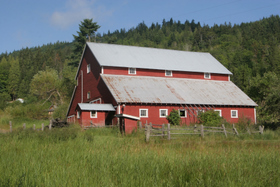
Red Barn on Hwy 112
by Dave Logan
Joyce General Store
by Randall J Hodges
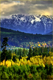
Mountain view
by Randall Tomaras
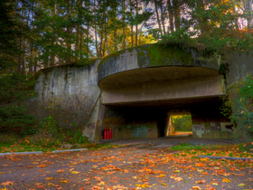
Salt Creek Rec Area
by Randall Tomaras
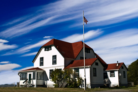
Slip Point historic building
at Clallam Bay
by Randall Tomaras
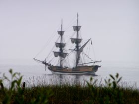
Tall Ship
by Martha Ellul
A Brief History of Highway 112
The northern edge of the Olympic Peninsula has an extremely rich history. Since the last thick sheet of glacial ice pulled back from the land, people have occupied, survived and ultimately thrived on this strip of land between the mountains and the Strait of Juan de Fuca. Down to this day, the Strait of Juan de Fuca Scenic Byway spans the ancient traditional land and current homes of the Klallam and Makah peoples. All other history is very recent in comparison. Below is a timeline of major events that have influenced this beautiful and unique part of Washington State.
|
10-12 million years ago |
The Olympic Mountains emerge from the sea floor. |
|
28,000 -12000 years ago |
The Strait of Juan de Fuca, Hood Canal and Puget Sound are carved by the last glaciation. The Olympic Mountain tops are ice capped islands surrounded by glacial ice. |
|
13,000 years ago |
The glaciers begin to recede and mastodons roam the Sequim area. Evidence has been found that people are here hunting them. |
|
5,000-6,000 years ago |
Coniferous trees and forest communities develop. |
|
1592 |
It is believed that a navigator named Juan de Fuca is part of the first European expedition to sail from the Pacific Ocean into the uncharted waters of the Strait. The information is lost or disbelieved for almost 200 years. |
|
1778 |
Captain James Cook sails north, missing the entrance to the Strait, but naming Cape Flattery as he passes. He is followed by other British and Spanish explorers and fur traders, who map and give names that remain today for many of the mountains and bays that they observe along the Strait. |
|
1792 |
Spanish forces build a rudimentary fort , “Nunez Gaona,” at Neah Bay. In spite of claiming the area for Spain, the Spanish only occupy Neah Bay for two months. This is the first non-Indian settlement in what would become Washington State. It was sadly the beginning of a time of horrific devastation of tribal populations by European diseases. |
|
1846 |
England and U.S. sign a treaty locking the northern boundary at 49 degrees latitude. This treaty still divides the Canadian/U.S. border east to west down the center of the Strait. |
|
1850’s |
Fur trappers, settlers and timbermen begin showing up in Washington Territory. Treaties are negotiated with local tribes, ceding most lands to the government and establishing reservations. |
|
1857 |
Cape Flattery lighthouse is built to aid the increasing ship traffic entering the Strait. |
|
1860’s-1890’s |
Small communities such as Port Crescent, Gettysburg, Twin, Pysht and Clallam Bay take root and thrive along the Strait west of Port Angeles. Most transport of people and goods is by water. Steam boats establish regular routes to serve these communities. |
|
1889 |
Washington becomes the 42nd state in the union |
|
1891 |
A primitive wagon road is built connecting Port Crescent to Lake Crescent, allowing settlers to welcome tourists to small fishing “resorts” on the lake. |
|
1911 |
At level ground along the road to Lake Crescent, Joe Joyce builds a home, a shingle mill and a general store. His Joyce General Store remains in continuous operation for 100 years in the community that still bears his name. |
|
1911-12 |
The first dam is constructed on the Elwha River, providing electricity to Port Angeles, but blocking salmon passage. An unpaved county road connects Port Angeles to the Joyce area. Most traffic is still horse-drawn. |
|
1914-1918 |
Railroad tracks are laid west out of Port Angeles, paralleling the Straits, passing through Joyce and going as far west as Deep Creek .There is some passenger service, but the prime objective is to haul timber to a new mill being built in Port Angeles. Twin Rivers is a major logging camp near the western terminus of the Chicago, Milwaukee and St. Paul track. |
|
1918 |
U.S. entry into WWI brings thousands of Spruce Division soldiers to the Joyce, Twin and Pysht areas. The men at Joyce are tasked with building railroad track around Lake Crescent towards the spruce forests near Forks. Spruce was the ideal wood for aircraft production. The war ended just as the track was completed. |
|
1915-1931 |
A road is built connecting Joyce to Lyre, then to Twin, Pysht, Clallam Bay, and finally Neah Bay. |
|
1936 |
The Civilian Conservation Corp [CCC] establishes Camp Twin. The men build roads and watch for forest fires. |
|
1938 |
Congress approves the establishment of Olympic National Park. |
|
1942 |
With the U.S. having entered WWII, the Army establishes camps in Clallam County, including Camp Hayden at Salt Creek, with major gun emplacements and several hundred soldiers at Crescent Bay. |
|
1952 |
All railroad tracks are removed west of Port Angeles. Logging trucks replace trains for log transport. |
|
1958 |
Having declared Camp Hayden surplus in 1949, the government sells the property to the County for use as a park. |
|
1970 |
Artifacts from a buried coastal village at Ozette are uncovered by storm surf. This begins a ten-year archaeological dig by the Makah Tribe and the University of Washington. |
|
1979 |
Makah Cultural and Resource Center opens to display artifacts from the Ozette dig site. |
