
Photo credits:
Header Photo
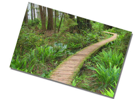
Trail to Cape Alava/Sand Point
by John Gussman
Trail to Cape Flattery
by Randall Tomaras
Hiker on Adventure Route
by John Gussman
Freshwater Bay Beach
by Randall J Hodges
Hikers at Tongue Point
by Randall Tomaras
Salt Creek/Tongue Point
by Randall Tomaras
Tongue Point Tidepools
by Dave Logan
Merrill & Ring Tree Farm
by John Gussman
Forest floor
by John Gussman
Clallam Bay Bridge
by Randall J Hodges
One Mile Beach, Sekiu
by Randall Tomaras
Trail to Ozette
by
Hikers at Sand Point Beach
by
Cape Flattery
by
Kids Hiking to Cape Flattery
by Dave Logan
Hobuck Beach
by John Gussman
Sunset at Shi Shi
by Randall J Hodges
Shi Shi Beach
by John Gussman
Hiking on the NW Coast
You have chosen one of the most beautiful places in the world to travel and visit. We hope that you’ll enjoy some fabulous walks and hikes along the byway. You will experience nature in so many ways. A list of suggested hikes, arranged by Milepost (MP), can be found on the left side of this screen. The byway "begins" from the east (just outside of Port Angeles) at Milepost 61 and travels to Neah Bay, just west of Milepost 1 -- this is how the hikes are listed. Below are some suggestions to help with your experience.
- Leave vehicles in designated parking areas, not on the side of the highway.
- When beach hiking, be aware of tides which can block your way on most headlands at high tide. Also use caution hiking beaches in the winter, as storms can be fierce and unexpected. Tides can also carry large debris (logs) which are very hazardous.
- Stay on designated trails to avoid harm to sensitive areas such as meadows, lakeshores, wetlands and streams.
- Respect the rights of private property owners.
- Pack out what you pack in.
- When encountering horses on the trail, move to the downhill side of the trail, stop, and ask the rider the best way to proceed.
- Pets are welcome on most trails unless otherwise noted. Bring a leash and please pick up after your pet.
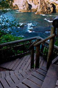
MP 60-59 Adventure Route
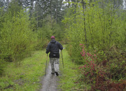
The 25 mile "Adventure Route" is a dirt trail suitable for mountain bikes, equestrians and hikers. It opened in summer 2008, connecting the Olympic Discovery Trail from the Elwha River west of Port Angeles to the north shore of Lake Crescent.
Directions:
The trailhead is located off Highway 112 between Milepost (MP) 60 - 59. There is a large sign: "Olympic Discovery Trail - Adventure Route." Parking is available nearby.
More info:
Adventure Trail Map (pdf)
MP 57 Freshwater Bay
Take a walk on a rocky beach cove along the Strait of Juan de Fuca on Freshwater Bay, and watch the scenery change before your eyes! If you watch closely off of the horizon, you will see plenty of marine traffic: an assortment of powerboats, sailboats, occasional kayaks, barges, freighters, and container cargo ships headed for Port Angeles and Puget Sound. And while looking, don’t be surprised to find marine traffic of the natural variety: whales and seals.
Directions:
From Highway 112 at Milepost (MP) 57, turn north on to Freshwater Bay Road. Follow for about 2.7 miles to the county park and beach.
MP 53 Salt Creek Rec Area - Striped Peak, Tidepools
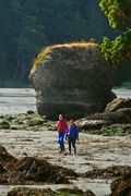
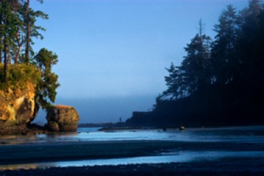
Two adventures in one await you at Salt Creek. First, hike to a 1000-foot peak (Striped Peak) rising above the Strait of Juan de Fuca. This five-mile round trip hike is on a good trail, but is poorly marked. You will find your way along the coastline through deep forest and across many creeks, before reaching the peak. Your reward will be breathtaking views of the Strait of Juan de Fuca and Canada's Vancouver Island. On your way back, take the unmarked trail (right turn) down to “the cove.” There is a small waterfall that drops about 30 feet tumbling over a mossy rock face.
Then head directly to the Strait to explore a series of world-renowned tidepools up close. The tidepools are best viewed during low-tide. Tidepool hikers should wear good shoes since rocks can be slippery and sharp. Finish up the day with a leisurly wander across the sandy beach on picturesque Crescent bay.
Directions:
From Highway 112 at Milepost (MP) 53.8, turn north on Camp Hayden Road. Follow for about 3.5 miles to the county park entrance.
MP 45 Lyre Conservation Area
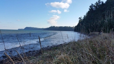
Photo by Lindsey Aspelund
In December 2015, the Byway welcomed the addition of a new point of interest. The Lyre Conservation Area is a 280-acre property just east of the Lyre River. Its beach access trail is now open to the public. The 1-mile trail winds through diverse and beautiful upland forest, before opening onto the Lyre River estuary and a ½-mile of beach along the Strait. The Conservation Area supports a wide variety of migratory and resident birds, wildlife, and salmon habitat. Enjoy hiking, biking, and horseback riding along the trail (non-motorized access only).
Local surfers report that the hike, even while packing a surf board, is well worth it!

Directions:
Traveling West on Hwy 112, turn right on Reynold Rd [Milepost 46.8]. Two parking areas have been established near the end of Reynold Rd. From the parking area, visitors will enjoy a one mile walk down to the beach.
Day use only. There are no restroom facilities. There are no trash cans, so if you pack it in, please pack it out.
Dogs permitted (on leash).
Fishing access: The Lyre Conservation Area is only able to provide fishing access to the Lyre River estuary. The main stem of the Lyre River is not located on this property. Please respect neighboring private property and do not trespass.
MP 29-28 M & R Tree Farm
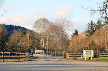
A hike through the working commercial forest begins at the old logging camp at Pysht, ten miles east of Clallam Bay on Hwy 112. This historic tree farm is the main holding of the oldest family-owned timber management company in Washington State, established in 1886. Many of its original buildings have been lovingly preserved, and there are still quite a few old-timers in the area who remember the days when forestry was practiced with the double-bit axe and the misery whip.
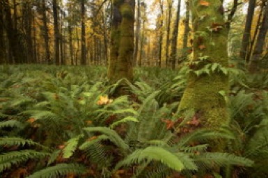
Merrill & Ring (M & R) was an early pioneer of replanting, and as a result, the forestry units on the Pysht Tree Farm are of all age classes and thriving. A walk along the Forestry Trail (a self-guided tour) shows the succession of trees on a forestry unit from planting to harvest.
More Info:
Access to the Tree Farm must be arranged in advance. For reservation scheduling, please contact the Merrill & Ring Pysht Tree Farm forester at 360-460-3733.
Directions:
The Tree Farm entrance is located between Milepost (MP) 29 - 28 off Highway 112.
MP 17-16 Clallam Bay & Slip Point Beach Park
Clallam Bay Spit County Park is located in the center of Clallam Bay where the nutrient-rich water of the Clallam River empties into the Strait of Juan de Fuca. This provides a constant food source for shore and marine birds, which are often seen here in great numbers. The dynamic hydrology interaction between the Clallam River and the tides provide an opportunity to witness drastic changes to the landscape each time you visit.
There is public access to the Clallam Spit where you can follow the sand/gravel beach for one mile. Slip Point to the east is an outdoor aquarium - one of the best exhibits you'll ever see of tide pool animals and sea life. The historic lighthouse residence still sits on the point overlooking the windswept cape (it is not open to the public). The community hopes to rebuild the lighthouse and have a maritime museum here in the future.
Directions:
The entrance to the county park is located between Milepost (MP) 17 - 16 off Highway 112, in the town center of Clallam Bay.
MP 15 Sekiu Trail
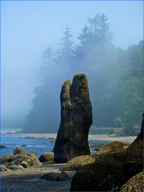
Sekiu Trail, also known as "One-Mile Beach," is a straight and relatively level saltwater beach trail. At low tide, it connects beautiful rugged slate caves to the east with Eagle Point two miles to the west. Boaters fish near the trail, unaware of the old abandoned railroad grade that runs the length of the hillside above. The flat and forested trail is an easy walk from Sekiu resorts and provides access to solitude, sand and surf. Views from the trail stretch across the Strait of Juan de Fuca to Vancouver Island.
Depending upon the time of year and movements of the wind and tide, an explorer with a good pair of binoculars can spot gray whales, sea lions, or furry corks (called sea otters) bobbing just off the beach. Eagles, osprey, loons, and puffins are also regular visitors.
Start your hike from the north end of Sekiu at the Three Sisters rock formation and continue up the hill to the northwest, following the old railroad grade. One-Mile Beach is surrounded by sea grass and perfect for strolling, beach combing, bird watching and picnicking.
At low tide, Half-Mile Beach offers curious hikers a number of caves and wonderful tide pools atop high rocks to explore.
Directions:
The Sekiu trail can be found at Milepost (MP) 15 off Highway 112. Drive through the fishing village of Sekiu to the north end where you will find parking near the marina.
MP 13-12 Ozette Wilderness Hike
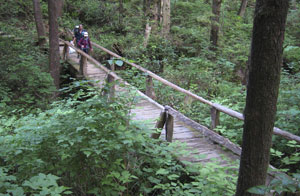
Cape Alava/Sand Point Triangle Hike
Travelers will find the northwest entrance to Olympic National Park’s 57 miles of coastal wilderness at Lake Ozette. The Lake Ozette trailhead for the world famous Cape Alava trail is by the Ranger Station and heads to the north; the Sand Point trail heads to the south. Both trails are three miles of easy cedar-planked walking to beautiful primitive beaches. Along the three-mile ocean leg between these two points, hikers will find 54 ancient petroglyphs carved at Wedding Rock. The full nine-mile loop hike can be easily completed at low tide and takes five to six hours. 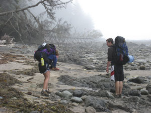
Cape Alava is the site of an ancient Indian village that was buried by a mud slide over 500 years ago. Excavated in the 1970's, the relics are now preserved and beautifully displayed at the Makah Museum.
At 7,787 acres, Ozette is one of the largest natural lakes in Washington, with 57 miles of shoreline, and is very deep at over 300 feet. Campgrounds at the lake's edge and nearby invite you to picnic, fish, swim, canoe or kayak to the many islands. On Lake Ozette, Erickson Bay Campground can only be reached by boat. Boat launches are available at Swan Bay, Rainier Landing or the campground near the Ranger Station.
Directions:
From Highway 112 past Clallam Bay, turn southwest onto the Hoko-Ozette Road, follow 21 miles to the Ozette Ranger Station.
Neah Bay - Cape Flattery Trail
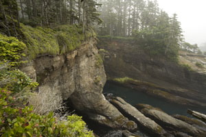 To the west of Neah Bay at the very northwest tip of the Olympic Peninsula, you’ll find Cape Flattery, the most northwestern point in the contiguous United States. Located on the Makah Indian Reservation, a cedar plank boardwalk takes you on a moderate hike to viewpoints overlooking both the Pacific Ocean and the Strait of Juan de Fuca. Directly west you will see Tatoosh Island, a former Makah fishing and whaling camp and the site of the historic Cape Flattery Lighthouse. Tatoosh Island is a sacred place for the Makah.
Walk along the 3/4 mile of groomed trail, cedar boardwalk and foot bridges that cross the wetlands. The 20 to 30 minute hike is well worth the breath-taking views. In summer, there are Makah interpreters on the trail to share the historic and cultural significance of the area, as well as traditional uses of the native plants.
Directions:
Highway 112, at Milepost 0, becomes the Makah Reservation. After purchasing your recreation permit, continue west through the reservation to the Cape Flattery Scenic Byway which leads to the parking area for this hike.
More info:
A Makah Recreation Pass must be purchased in Neah Bay prior to arriving at trailheads, tel: 360-645-2201. Makah Recreation Passes are available in Neah Bay at the Makah Tribal Council, Warm House Cafe, Makah Marina, Big Salmon Fishing Resort, Washburn's General Store, Raven's Corner or the Makah Mini Mart. Permits cost $10 per car and they are valid for the calendar year during which they are purchased. If you are planning a visit to Neah Bay, camping is permitted only in designated camping areas.
Neah Bay - Hobuck Beach
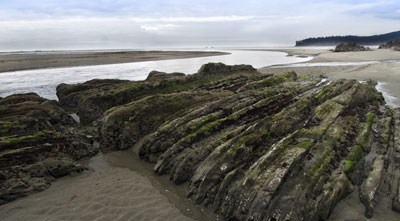
Hobuck is a favorite local public beach known for its flat and sandy shoreline, making it very popular with beach hikers, surfers, surf-kayakers, and families. It is very remote and offers beauty and serenity as well as recreation. At low tide, investigate the many creatures living in the tidepools. Hobuck is also known for amazing sunsets over the bay. You will need a recreation permit to visit the beach.
Directions:
Highway 112, at Milepost 0, becomes the Makah Reservation. Continue west through the reservation and turn left at the bridge by the Tribal Center. Take a hard right turn off the bridge onto the gravel road to Hobuck Beach This road will meet up again with the paved road south to the fish hatchery.
More info:
A Makah Recreation Pass must be purchased in Neah Bay prior to arriving at trailheads, tel: 360-645-2201. Makah Recreation Passes are available in Neah Bay at the Makah Tribal Council, Warm House Cafe, Makah Marina, Big Salmon Fishing Resort, Washburn's General Store, Raven's Corner or the Makah Mini Mart. Permits cost $10 per car and they are valid for the calendar year during which they are purchased. If you are planning a visit to Neah Bay, camping is permitted only in designated camping areas.
Neah Bay - Shi Shi Beach
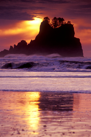
Shi Shi Beach is located west of Neah Bay and is part of Olympic National Park and Olympic Coast National Marine Sanctuary. Shi Shi (pronounced shy-shy) was named "best nature beach" by the Travel Channel. The Makah Tribe, whose reservation borders Shi Shi to the Ozette River beaches, is rebuilding the Shi Shi Beach Trail for easier access. However, the stunning seastacks, caves and arches, as well as the fascinating miniature life in numerous tidepools, make it well worth the effort (about three miles). Located on the south end of Shi Shi Beach, Point of Arches is probably the most stunning set of sea stacks you'll ever see, with bold arches, intriguing tunnels and amazing tide pools. 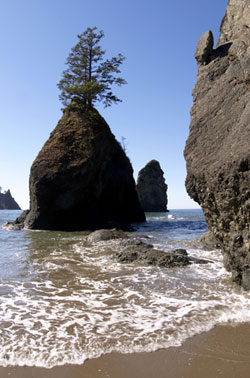
Directions:
Highway 112, at Milepost 0, becomes the Makah Reservation. Upon entering the reservation, you will need to purchase a recreation permit. Continue west, turn left on Cape Flattery Road and drive three miles to Hobuck Beach Road. Turn left and continue to drive (the road becomes Sooes Beach Road) to the trailhead that is clearly marked on the right. The parking area is for day use only. Overnight parking is only allowed in designated private parking lots. Watch for signs.
Shi Shi Beach can also be accessed by hiking from the Ozette Wilderness area shoreline.
More info:
A Makah Recreation Pass must be purchased in Neah Bay prior to arriving at trailheads, tel: 360-645-2201. Makah Recreation Passes are available in Neah Bay at the Makah Tribal Council, Warm House Cafe, Makah Marina, Big Salmon Fishing Resort, Washburn's General Store, Raven's Corner or the Makah Mini Mart. Permits cost $10 per car and they are valid for the calendar year during which they are purchased. If you are planning a visit to Neah Bay, camping is permitted only in designated camping areas.
Olympic National Park - Shi Shi Beach
Olympic National Park - Hiking the Wilderness Coast
National Marine Sanctuary/National Oceanic & Atmospheric Administration
